Hampton Court to Staines - February 7th 2020
The Route
This walk starts from the south bank of the river at Hampton Court. After leaving the last of London's boroughs, the river flows into Surrey and passes a number of towns including Walton-on-Thames and Chertsey. The walk finishes when the river reaches Staines, the largest town on the walk.
The highlight of the walk is a ferry crossing at Shepperton Lock, where the path switches from the south bank to the north bank!
This section is meant to be about 12 miles.
My Walk
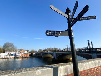
Another cracking start to the day. Usual method of getting to the start - train to Kings Cross, then Victoria Line to Vauxhall, where I caught the train to Hampton Court. This walk started on the south bank. Very soon Molesey Lock came up. This is the 2nd longest lock on the river after Teddington.
After passing the lock and weir, Tagg's Island came into view. The island is owned by the residents' association. No houses are permitted to be built; instead owners live in houseboats. Some of the Thames' most expensive houseboats are on this stretch of the river, known as the Thames Riviera and are arranged over up to three storeys.
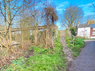
The path continued with the very attractive greenery of Hurst Meadows & Park to the left. Soon the views to the right opened up to be able to look across to Hampton with its attractive church. For the next mile or so the path continued along the towpath with trees and hedges on both sides. Very pleasant but nothing of any real interest to see.
Sunbury Lock came up next. It looks like there are 2 lock keepers' houses here, some distance apart but the 2nd one was built on the site of the original lock and is now privately owned. There was a footbridge over the river at the 2nd house. This leads to Sunbury Lock Ait. An"Ait" is a small island. The island is unpopulated but there are private moorings and a boat repair yard.
The path continued towards Walton-on-Thames. Again, not a great deal to see, mainly residential properties with riverside frontages on the other bank of the river. As I approached Walton, its striking road bridge came into view. The bridge is a really attractive structure (in my opinion) and I believe it must be the newest road bridge across the Thames, having been opened in 2013. There were a number of benches overlooking the river at Walton, along with a large number of swans and geese. I chose to stop here to take a break and eat my lunch under the watchful gaze of the wildlife, anxious for some of my sandwich!
From Walton, the path continued alongside an almost dead straight artificial channel named Desborough Cut. This was dug in the 1930s between Weybridge and Walton to reduce the risk of flooding, improve flow and ease navigation of the river. It cut out a meandering section of the river and in so doing, halved the travel time for that section. In digging this channel, it created an island, Desborough Island, for which 2 road bridges at either end were constructed.
At the end of Desborough Cut, I came to D’Oyly Carte Island. This is named after Richard D’Oyly Carte. D’Oyly Carte was a producer who first brought Gilbert and Sullivan together. He also founded the Savoy Theatre, Royal English Opera House and built the Savoy Hotel. He bought the island and built a large house on it, named Eyot House. His intention was to make the house a secluded annex to his Savoy Hotel. However, he couldn’t get a drinks licence, so it remained as a private residence. The house is now Grade II listed. In 2019 it was put up for sale at £3.2 million. At the time of my walk, it did all look a little spooky!
The highlight of today’s walk came next – the ferry! This crosses the river to link Weybridge with Shepperton for pedestrians and cyclists. It runs every 15 minutes during the day and is summoned by ringing a bell on the quarter hours. Accordingly, I rang the bell at 13:30 and waited…and waited but no ferry. I then read the small print on the sign by the bell and rang the number quoted. This slightly higher tech approach was more successful and minutes later the little boat came across from the other side. I paid my £2.50 and a couple of minutes later I was on the north bank. If for any reason the ferry hadn’t been running, I would have had to walk back to Walton Bridge, cross the river there and then take a much longer walk through Shepperton to reach the same point.
Back on the path, for the next mile or so I walked past plenty of expensive looking riverside properties on both sides of the river. I passed Pharaoh’s Island, which has 25 houses built on it but is only accessible by boat. Apparently, most of the properties have Egyptian names! The further I walked, the fewer the houses I passed and the landscape became much more rural. Eventually, after the river had made 3 bends from Shepperton Lock, Chertsey Bridge came into view.
Chertsey Bridge is another really attractive bridge, opened in 1785 and is Grade II listed of course. Almost immediately after passing the bridge, Chertsey Lock came up. The path next passed under the M3 motorway and continued right by the riverside to Laleham, which marked the start of a more urban feel to the path, with houses on both banks.
Penton Hook Lock came up next. Penton Hook Island is accessible from the lock. This is a small island that is now a nature reserve and is apparently a great place for having picnics.
From Penton Hook Lock, the density of housing on both sides increased as I got closer to the centre of Staines. Having passed under the extremely ugly railway bridge, I finally reached Staines Bridge, the end of today’s walk. Staines officially became Staines-upon-Thames in May 2012 to try to boost the local economy by promoting its riverside location.
My step count for the day was boosted as I walked another ¾ mile to Staines railway station to get the train back to London.
Gallery


