Henley-on-Thames to Sonning - March 6th 2020
The Route
This walk was meant to start at Henley and end at Tilehurst. However, flooding of the river in various places along the route put paid to this, resulting in a much shorter walk!
Starting on the north bank of the river at Henley, the path follows the river as far as Lower Shiplake, where it takes to the streets before rejoining at Shiplake Lock. The path then continues through open countryside as far as Sonning Bridge where it switches to the south bank. The reality was that once I reached Shiplake College, the river was flooded and I had to walk up to the main road and walk along this instead to Sonning Bridge.
This section from Henley to Sonning is meant to be about 6 miles.
My Walk
I was taught a lesson on this walk. Before setting off I should have checked the Government’s Flood Information Service – https://flood-warning-information.service.gov.uk/warnings Alternatively, I should have brought my wellies with me!
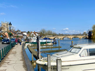
Anyway, in blissful ignorance I set off from home on yet another sunny morning. I drove to Henley and parked in the station car park. The walk started at Henley Bridge on the north bank of the river. For almost a mile, the path was tarmacked. I noticed that the water level was rather high but didn’t give it a second thought.
Shortly before Marsh Lock, the path directed me onto a wooden bridge. Because the lock is unusually situated on the opposite side of the river to the path, a long wooden bridge was built from the bank to carry the path out to the lock island below the weir and then back again to the riverbank above the weir. This feature is unique on the River Thames.
Once back on dry land, the path continued alongside the river through open meadows that gradually got muddier and muddier. Eventually the path went off to the right and into Lower Shiplake. Numerous Thames Path signs directed me through Lower Shiplake past large, mainly gated houses and eventually brought me back to the river at Shiplake Lock. I stopped here to eat my lunch. The walk through the village cut off a sizeable bend in the river and I assumed this was because the towpath was impassable for this section.
The day’s fun started after lunch. I set off again alongside the river but due to the soggy nature of the fields I found that I was having to walk further and further away from the riverbank. At the Shiplake College boathouse the path was completely flooded and whilst my walking shoes were waterproof, they couldn’t deal with the depth of water ahead of me. I took the decision to leave the path here, walk up to the main road, walk along this road to Sonning and then continue along the path to Tilehurst.
The A4155 is the main road between Henley and Reading and hence is very busy. It doesn’t have any pavements, just uneven grass verges. I ended up walking an unpleasant 3 miles along this road, with large trucks thundering by. Once off the A4155 I had to walk along the road into Sonning. I eventually reached Sonning Bridge, which is where the Thames Path would have brought me. Looking back along the path towards Shiplake, within just a few yards it was still flooded, so definitely the right decision.
Thinking (or rather hoping) the path towards Reading and Tilehurst would be OK, I crossed Sonning Bridge to the south bank of the river as directed by the signs and continued towards Sonning Lock. About half a mile beyond the lock, the path opened up into Thames Valley Nature Reserve, which is a very large, very flat meadow by the side of the river – and was also under a lot of water, not surprising really since it was developed as a natural flood plain! Forward progress was not going to happen! Two fellow walkers were in the same predicament as me. I could see from the map on my phone that there were a number of paths to our left that theoretically would bring us out on a business park and dry land. So, the three of us set off but very soon we all had water in our shoes! The two ladies admitted defeat and decided to retrace their steps back to Sonning. I persisted in trying to reach the business park but all the buildings had security fencing around them with no means of getting through. Eventually I too conceded and walked back to Sonning.
I now had to figure out how to get back to my car, as Sonning doesn’t have a railway station. After a half hour wait, I got a bus to Twyford, then a train to Henley. Before getting back in my car to drive home, I had a wander around the shops in the town, looking for a pair of socks, since the ones I had on were soaked. Back at my car, I changed my shoes and socks and drove to my sister’s house, as she had promised me a sneaky pint at her local and tea!
This was to be my last Thames Path walk for nearly three months, as lockdown and the flooding of course, prevented me from doing any more.
Gallery


