Sonning to Tilehurst - May 29th 2020
The Route
This walk picks up from where I had to admit defeat on March 6th due to flooding. Switching from the north to the south bank, the path tracks the river as it flows into Reading, one of the largest urban areas in the UK that does not have city status. Once out of Reading, the path continues out to the suburb of Tilehurst.
This section is meant to be about 7 miles.
My Walk
The rules on lockdown were relaxed earlier in May to allow me to take unlimited exercise and drive as far as I liked in England to do that exercise. What I couldn’t do legitimately was to use public transport to get to my destination. Whilst I’d been doing lots of long walks around where I live, I was getting more and more itchy to get back to the Thames Path and complete a walk I’d started nearly 3 months earlier. So, I decided that I’d drive to Tilehurst, walk from there to Sonning and then walk all the way back – no rules broken! As it turned out, my FitBit told me I walked nearly 17 miles that day.
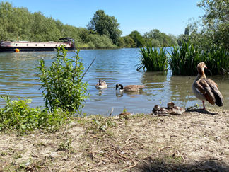
We had amazing weather for much of lockdown, which I’m sure all parents of school age children appreciated. May 29th was no different with unbroken sunshine all day. Driving to Tilehurst was a breeze because back then there were so few cars on the roads. I parked my car at Tilehurst railway station and then started my walk to the river by following the main road towards Reading. I had to ask someone how exactly I could reach the river as I could see the rail tracks stood between me and the river. I was advised to carry on and after a large Waitrose, turn left down Scours Lane. I popped into Waitrose having donned my face mask and bought a sandwich for my lunch. Turning left as instructed took me through a very scruffy industrial estate and under a railway bridge but eventually I reached the river with swans, geese and ducks waiting expectantly to be fed by passers by.
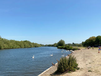
What an immediate contrast from the scruffy road I’d just walked down, to this peaceful, tranquil riverside path, with all the trees now in full leaf, green fields, a blue sky and occasional boats and narrowboats passing slowly by. After just a few minutes of walking along the path, I decided a perfect therapy for people struggling with mental health issues arising from lockdown would be to do this walk, or at least one similar to this!
Anyway, after about a mile, houses started appearing along the other side of the river, all of which were of course large, with boat houses, boats moored up etc. – no house envy you understand! At about this point, the gravel path changed to a tarmacked path which continued for much of the walk. Gradually the fields on my side of the river gave way to a more formal park. Rivermead Park is a huge green space with plenty of benches as well as trees that provide shelter from the sun. On the day of my walk there were plenty of people here, home schooling, relaxing, feeding the swans and geese and having picnics.
Caversham Bridge came up next. This carries a road connecting Caversham on the north bank of the river to the main town of Reading on the south bank. Shortly after walking under Caversham Bridge, a sizeable island in the middle of the river came up. This is Fry’s Island, also known as De Montfort Island. Fry's Island is a natural island, the only access to it being by boat. It is home to a private house (Demontfort House), a boatyard with a residence (Caversham Boat Services) and a private bowling club (the Island Bohemian Club). Each of these occupants runs their own private ferry service.
Immediately after Fry’s Island came Christchurch Bridge. This is a very attractive pedestrian and cycle bridge, opened in 2015 and connects Reading town centre with Christchurch Meadows in Caversham. All the way along my side of the path were apartment blocks and office buildings. Of note was the Thames Water building which I found really striking in a positive way. Next came Reading Bridge, another attractive road bridge connecting Reading with Lower Caversham.
After Reading Bridge the path continued to Caversham Lock. This lock and weir are very interesting (to me anyway!). It’s possible to cross from the Reading side of the river to Lower Caversham over 3 islands called Lock Island, View Island and Heron Island. This entails crossing the lock, the main weir and footbridges.
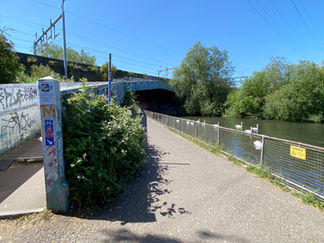
The path then continued through a very large, pleasant green space called Kings Meadow. This gave the path a more rural feel – for a while anyway. After passing a large Tesco Extra store, the path reached the point where the Thames met the mouth of the River Kennet. To continue towards Sonning it was necessary to cross a bridge over the Kennet. This bridge is called the Horseshoe Bridge and hands down wins my award for the ugliest structure I had to cross along the path; it’s hideous and not helped by the graffiti adorning it! I’ll let my photos do the talking here.
Shortly after the Horseshoe Bridge, the path opened up into Thames Valley Park, a high tech business park with tenants including Microsoft, Oracle, Opentext and HP. The park, water meadows and nature reserve were developed to create a natural flood plain to protect the commercial development, improve natural habitats and increase local biodiversity. The nature reserve covers 80 acres. The flooding here in March was what put the kybosh on my last Thames Path walk. In stark contrast to March, there were plenty of people relaxing and enjoying themselves by the riverside. It was hard to believe that up until it was demolished in 1986, this was the site of Earley Power Station.
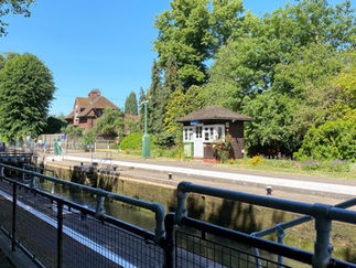
Beyond the nature reserve the path continued to Sonning Lock, before finally arriving at Sonning Bridge, the end or you could say the beginning of this walk, since I had to retrace my steps and walk all the way back to Tilehurst! I got talking to a couple of ladies who were also doing the Thames Path walk and we walked together (observing social distancing) from the nature reserve to Sonning – some nice company for a short while. Sonning Bridge was built in 1775, is Grade II listed and really attractive. I found a bench overlooking the bridge and ate my lunch. I then had a quick wander around Sonning before starting back towards Tilehurst.
Back at Tilehurst, it seemed a waste of a lovely day to drive straight home. I therefore drove to Pangbourne, which is where the next section of the Thames Path would bring me. Pangbourne Meadow overlooks the striking Whitchurch Bridge. It was really busy with people relaxing by the river. I found a quiet spot and had a piece of coffee and walnut cake and a beer – bliss! What a great end to my first Thames Path walk since before lockdown started.
Gallery


