Wallingford to Goring - July 2nd 2021
My Walk
The Thames Path between Wallingford and Goring takes the right/south bank of the river to Streatley where it crosses the road bridge to Goring. This necessitates a walk along the A329 through Moulsford for about 0.8 miles as well as about 2 miles of Cholsey Marsh Nature Reserve. I’ve got nothing against the nature reserve but it is quite overgrown and you see very little of the river. The total distance of this section is nearly 7 miles.
I was alerted by the good people behind Walk The Thames (walkthethames.co.uk) that there is an alternative route along The Ridgeway National Trail that follows the left/north bank to Goring. I decided I had to give this route a try as I’d found the Moulsford and Cholsey Marsh part of this section a little uninspiring.
So, for this walk I first drove to Goring, parked my car and caught a bus to Wallingford. The start of this walk follows the Thames Path as far as the Wallingford bypass bridge – Winterbrook Bridge. The Thames Path continues under this bridge towards Cholsey but on this occasion, I left the path and crossed the bridge to the other side of the river. For the rest of the walk I would be following the distinctive black Ridgeway signs.
After first passing through the small village of Mongewell, the path continued either side of a golf course belonging to The Springs Resort and Golf Course. At one time the house and 133 acres of land were owned by Deep Purple’s Ian Gillan. He & his girlfriend spent a fortune refurbishing the house and they even had a guitar shaped swimming pool constructed at the property. The shape of the swimming pool can clearly be seen from Google Earth but it also looks like it's been filled in.
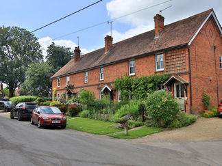
After the golf course, the path entered the village of North Stoke. What a pretty village it is! From North Stoke the path continued through some beautiful countryside with the Chiltern Hills to the left and the Thames – hidden by trees etc – to the right. Eventually the path emerged at Little Stoke, right by the river, opposite a point I recognised immediately. I was opposite the point where the Thames Path intersects with Ferry Lane Cholsey, either side of Cholsey Marsh. As the name suggests, there used to be a ferry here from Cholsey to Little Stoke. The tow path also crossed the river here and The Ridgeway utilises this tow path between here and opposite the Beetle & Wedge pub in Moulsford. This is the reason why the Thames Path had to divert through Moulsford before rejoining the river at the pub at the end of the second Ferry Lane of the walk! Again, there was a ferry here at one time and the tow path also crossed back here.
The best bit about this small section between Little Stoke and the Beetle & Wedge is that you get to see the back of some of the large properties you pass as you walk through Moulsford. You also get to see the boatyard and chandlery you would otherwise have to go out of your way to see. Importantly, you still get to pass under the 2 Moulsford railway bridges. Having reached the end of the towpath, opposite the Beetle & Wedge, the path took a left up yet another Ferry Lane.
This last Ferry Lane emerged in another beautiful little village – South Stoke. It was another warm day and as it was lunchtime, a cooling beer at The Perch & Pike was beckoning. Duly refreshed, I took to the path again. The last mile or so between South Stoke and Goring was extremely pleasant with good views of the river to the right for much of the way. Some of this involved walking along residential streets and a great deal of house and garden envy!
The distance covered on this walk is virtually the same as if you use the official Thames Path. In my opinion I have to agree with the people behind Walk The Thames, that this section of the Thames Path could have been planned a little better. It was a thoroughly pleasant way to spend 3 hours!
Gallery


