Windsor to Bourne End - February 26th 2020
The Route
This section starts on the north bank of the river at the footbridge connecting Windsor with Eton. Much of the walk as far as Bray is in open countryside. The path continues into Maidenhead, where it crosses the bridge and then carries on along the south bank. It’s briefly forced to leave the river more or less opposite the National Trust Cliveden Estate and continues into the village of Cookham. Once back by the river, the path continues through open countryside to the railway bridge at Bourne End.
This section is meant to be 11 miles.
My Walk
Since my last Thames Path walk on 11th February, we were hit by storm Dennis, as well as plenty of rainy days in general. This was more or less the first day since my last walk where the weather was forecast to be dry and reasonably sunny. To get to the start I repeated the journey I’d made a couple of weeks earlier when I walked from Windsor to Staines. Once I got to Windsor station, I made my way down to the riverside again where large numbers of swans, geese, gulls and pigeons were waiting expectantly to be fed!
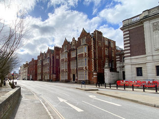
I crossed the footbridge that connects Windsor with Eton. I took the opportunity to delay the walk whilst I had a quick look at Eton. Eton High Street is quite narrow and has many shops and restaurants, most of which are independents. At the end of the road was the building I really wanted to see – Eton College Chapel. Shame I couldn’t go in as I would have loved to have seen the impressive organ in particular.
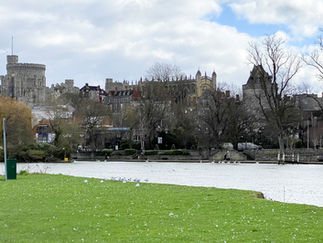
Anyway, I walked back down the High Street and joined the Thames Path. The path first entered a meadow known as The Brocas, which in summer is a great place for picnics, with its views of the river and the castle. However, on a cold February morning I chose to keep walking. Windsor Railway Bridge came up next. This carries the line that runs between Windsor and Slough. Unlike many railway bridges, I found this reasonably attractive.
Next came a couple of bridges over a brook that went off to the right. The brook would emerge about half a mile further on, meaning in effect the path was now on an island. The island is called Cuckoo Weir Island. On the other side of the river, Royal Windsor Racecourse was clearly visible.
Boveney Lock came up next. Whereas much of the walk is in Berkshire, the north bank of the lock is in Buckinghamshire. Shortly after the lock I saw some signs for Dorney Lake and knowing the 2012 Olympics rowing events were held here, I decided to explore. The lake is home to Eton College Rowing Centre and is 2,200 metres long. Great Britain was the most successful nation at the games winning 4 gold, 2 silver and 3 bronze medals. The public are allowed to walk along the perimeter of the lake and the rest of the 400 acre site the lake is set in.
Back on the walk again, the path continued by the riverside with Dorney Lake to the right but mainly hidden from view by trees and hedges. A building of note on the other side of the river was Oakley Court, a very large Grade II listed Victorian Gothic house that is now a hotel.
Bray Marina on the opposite bank came up next followed by a footbridge across the river called Summerleaze Bridge. I found the history of this bridge really interesting. Work on creating Dorney Lake began in 1996 and it was completed 10 years later. In this time more than 6 million tonnes of sand, gravel, top soil and sub-soil were excavated, most of it by Summerleaze Limited. A 2 mile conveyor belt was constructed to move much of the sand and gravel to a collection point across the river in Bray. Summerleaze had this bridge built in 1996 and as well as being a footbridge, it had the conveyor belt slung underneath it. Once the work on the lake had been completed, the conveyor belt was removed.
The path continued along the riverside, with large houses on both sides of the river. In fact, the path crosses the gardens of several houses, no doubt to the displeasure of the owners! A huge bridge carrying the M4 came up next. At the time of my walk there was long term maintenance work going on, resulting in my path being blocked. To get through, a pontoon in the river had been constructed and I had to use this to progress further.
Bray Lock came up next. Between here and Maidenhead, there was virtually no development on this side of the river – just fields. However, on the opposite bank in Bray, there were plenty of large, imposing houses to be seen. As the path reached Maidenhead, I walked under a brick railway bridge. I wouldn’t normally have given it any attention but I read a plaque on it that said it had been designed by Brunel, had been completed in 1838 and that the brick arches are the widest and flattest of any brick bridge in the world!
Very soon I arrived at Maidenhead Bridge. This is a very attractive Grade I listed stone bridge opened in 1777. It carries the A4 – even after more than 240 years! I crossed the bridge onto the south bank to continue the walk. The path then continued on the pavement alongside the A1094 to Ray Mill Island and Boulters Lock. The island is now a public park, looked after by the local council.
Beyond the lock, the path left the pavement and continued on the towpath, with a number of large, beautiful houses to the left. Around here, the Jubilee River joined the river from the right. The Jubilee River is a manmade river dug in the 1990s and 2000s with the intention of lessening the risk of flooding in Maidenhead, Windsor and Eton. It flows roughly parallel to the Thames between Maidenhead and Eton, where it rejoins the Thames.
Eventually the houses ended and the path continued with open countryside to the left and steep woodland to the right. A few riverside cottages then came up on the right bank. These cottages are part of the Cliveden Estate, which the National Trust owns. Cliveden House is famous as the home of Lord Astor, where John Profumo, the Secretary of State for War, first met Christine Keeler in 1961. In 1963 their relationship and his denials of it, sparked the Profumo affair. Cliveden House itself, is not owned by the National Trust but is now a luxury hotel.
After Cliveden, the path was forced to deviate away from the Thames to the left and take to the streets into Cookham. Cookham is a pretty village. The path took me through the churchyard and then back to the riverside. From here, the path continued all the way to Bourne End Railway Bridge with totally undeveloped countryside to the left and amazing houses to the right. It was a lovely way to end a walk.
The railway bridge has a separate walkway by the side of the tracks. I crossed over and then followed the signs for Bourne End itself. When I got to the station I found that I’d just missed the train back into London and the next one was in an hour’s time. Rather than hang about, I decided to get a bus to High Wycombe and enjoy the Buckinghamshire countryside on a sunny afternoon. At High Wycombe I soon got a train back to Marylebone.
Gallery


