Windsor to Staines - February 11th 2020
The Route
Just to be different, I did the Staines to Windsor section in reverse! The walk starts on the south bank of the river in Windsor, close to the footbridge that connects Windsor with Eton. The path leaves the riverside briefly through the village of Datchet. It then continues through Old Windsor, Runnymede and then on to Staines.
This section is meant to be about 8 miles.
My Walk
For this section I decided to walk the route in reverse. To get to the start I got the train to Kings Cross, made my way across to Paddington and then got the train to Slough where I changed to the shuttle service to Windsor & Eton Central. Windsor station is a very grand construction, harking back to former glory years. However, it now only has a single line track and a platform that can only accommodate a 3 carriage train! Most of the station buildings have now been remodelled into a shopping and restaurant mall named Windsor Royal Shopping.
I exited the station with Windsor Castle right in front of me. I then made my way down to the riverside to start the walk proper. I set off in the direction of Romney Lock. Very quickly the path narrowed to a strip between the river and the railway line. The signs I was following then sent me through a private boat yard rather than alongside Romney Lock. The path widened and I went under the railway bridge carrying the line to Windsor’s second station. The path was now skirting the edges of Home Park with good views of the castle.
Victoria Bridge came up next; not a very pretty bridge in my opinion. The signs told me to cross this bridge to continue along the north bank, as the land on the south bank is private to Windsor Castle. The north bank towpath was surrounded by low quality trees and hedges, unlike the finely manicured lawns on the other side!
Soon, the path left the riverside and briefly took me onto the streets of Datchet. The path rejoined the towpath shortly before reaching Albert Bridge, a much more attractive bridge than Victoria Bridge. I had to cross this bridge to get back onto the south bank. A 200 year old cut called the New Cut came up next. It cuts out a sizable meander of the river. In digging this cut, an island called Ham Island was created. There are a number of luxurious houses on the island and vehicular access to these is by a reasonably unattractive single track metal bridge.
At the end of the cut, I reached Old Windsor Lock. Like almost all of the locks I passed, the lock keeper’s house was substantial and attractive – lucky lock keeper! With a number of welcoming benches, I stopped here to eat my lunch.
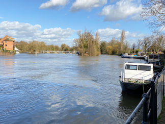
After the lock, the path continued right alongside the river. This section was characterised by houses on both sides, many of which were quite substantial and had boats moored up alongside. Soon, the path met up with the main road from Windsor to Staines, as it reached Runnymede.
Runnymede is best known as the site where Magna Carta was signed in 1215 by King John, marking what is to be considered to be the first step towards the birth of modern democracy. It is marked by a memorial erected in 1957 by the American Bar Association. This isn’t the only memorial at Runnymede. In a 1 acre piece of land donated to the United States in 1965, a statue remembering John F Kennedy was unveiled by the Queen. Further away on the site is a memorial to the Commonwealth Air Forces. There is also a piece of artwork unveiled in 2015 to commemorate the 800th anniversary of the signing of Magna Carta called The Jurors. The memorials and artwork are managed by the National Trust. I took the opportunity to break my walk to visit the site.
Back on my walk, the path passed a large statue of the Queen, again unveiled in 2015 to commemorate the 800th anniversary of the signing of Magna Carta. The river started to take a relatively sharp bend from here. As it straightened, both banks were given over to residential properties again. Bell Weir Lock came up next. Murals, yet again commemorating the 800th anniversary of Magna Carta had been painted on the lock keeper’s house.
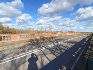
After the lock, 2 huge bridges carrying the M25 and the A30 over the river came up. Collectively the bridges are known as the M25 Runnymede Bridge but officially they are the Runnymede Bridge and the New Runnymede Bridge. It's a motorway, A-road, pedestrian and cycle bridge with a total of 14 traffic lanes and a pedestrian pavement! Once under the bridges, there was a great contrast between north and south banks as the river approached Staines. The north bank was really attractive with lots of trees and large houses, whereas the south bank was given over to offices and industry, including a water treatment plant.
Finally, Staines Bridge came into view, the end of today’s walk. As with the walk I’d done a few days earlier, I got my step count up by crossing the bridge towards the town centre and did the ¾ mile walk to the railway station to get the train back into London.
Gallery


